Huleia Stream is the major waterway of the Nawiliwili Bay Watershed. Therefore, we tend to think of them in the same way. And although it is officially named as a stream, because it is much larger than the other streams in the area, we tend to call it a river.
Below are a couple of articles by Jan TenBruggencate, Board Director and historian of Malama Huleia.
A Brief History of the Hulē’ia Region
By Jan TenBruggencate
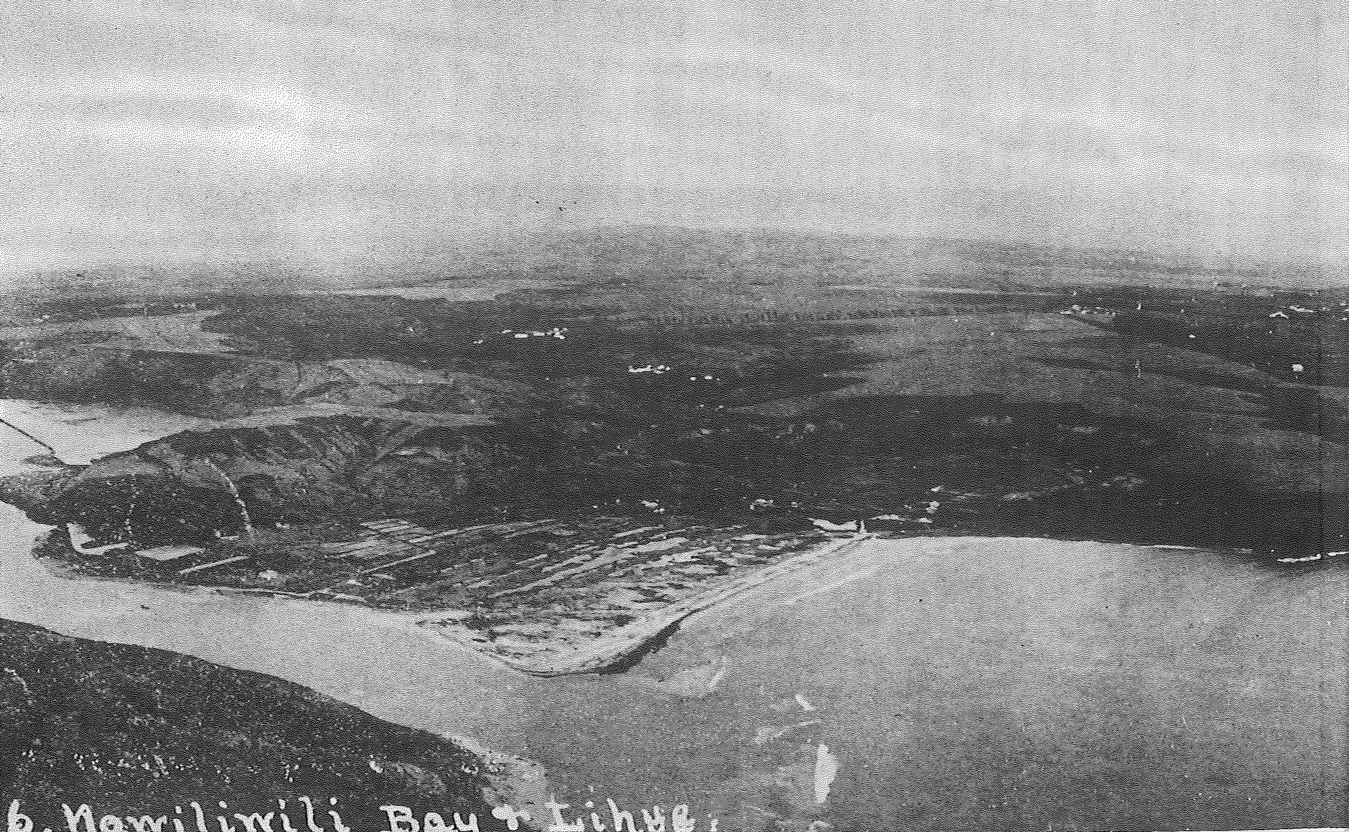
The Nāwiliwili and Hulē’ia region has been a center of Kaua’i activity since the earliest days.
The bay held the nearest safe anchorage for sailing ships from Honolulu, although it was a rough bay until the breakwater was built in 1922.
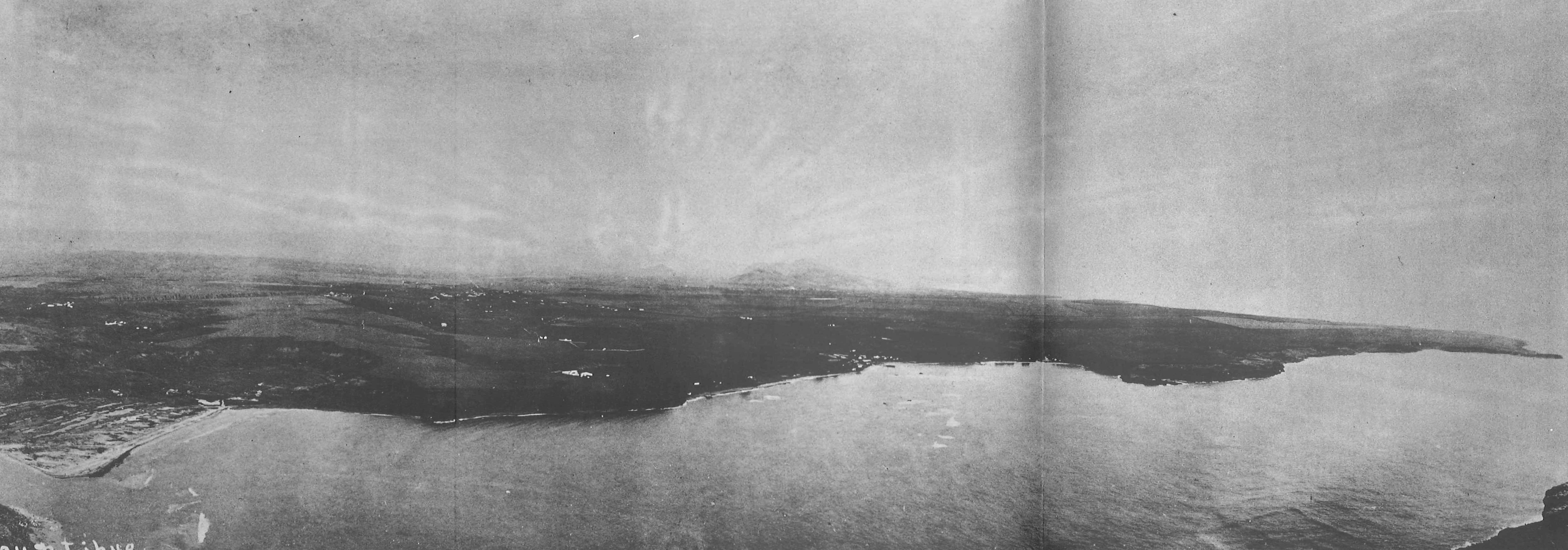
Its richness came in part from the abundance of fresh water. Many streams flowed into Nāwiliwili Bay, with Hulē’ia just the largest of them.
The others include Pū’ali Stream and Nāwiliwili Stream. Papalinahoa Stream was between them and has been diverted underground. Koena‘awa-nui Stream flowed into the middle of Kapalakī Beach, and there was another spring and stream at the eastern side of the beach, perhaps named Koena‘awa-iki. Papakolea Stream flows into Hulē’ia above the Alakoko fishpond.
The many steep-sided valleys of the region so impressed early residents that they attributed the rugged landscape to digging by the pig/man demigod, Kamapua’a.
The area is bounded to the south by the eight-mile-long spine of the Hā’upu Range. Geologists conclude that the Hā’upu Mountain range is the southern arc of the volcanic crater that formed the island of Kaua’i, and the many streams and valleys of the region are the result of the powers of erosion. The island is dated at 5 million years old so there has been plenty of time for wind and water to do their work.
The earliest archaeological dates in the area go back to about the year 1100. And numerous stories and traditions indicate the importance of this area.
The eastern peak overlooking Nāwiliwili Harbor from the south is Kalanipu’u, a place once used to spot schools of fish for fishers with canoes and nets in the waters below. Kalanipu’u is also famous in legend as a place where crops like mai’a (banana) and ‘awa (kava) were grown by Na Maka o Kaha’i, sister of the fire goddess Pele.
The hill to the west of the bay, where Kaua’i High School now stands, once held the four-acre heiau, Kuhiau, one of the largest and best-known Hawaiian temples on the island. Many of the peaks on the Hā’upu Mountain range, readily visible from Kuhiau, had astrological names, and may have been used in teaching navigation at the heiau.
To early Hawaiians of this area, the region was important for many reasons, among them its bountiful productivity.
Taro fields lined the stream valleys. Forests of koa, hala, wiliwili, hau, ‘ahakea and kukui covered its uplands. A rich estuary and bay as well as major fishponds fed its people.
The Nāwiliwili area had at least six fishponds, of which Alakoko was the largest. Others include Kalalalehua, Lokoponu, Papalinahoa and two whose names have been lost.
The winds of the region are also famous. They include the twisting wind Kiu Ke’e and the Hu’e One winds of Nāwiliwili; and at Kalapakī, the Wāmua and He Waikai Ko Kalapakī, which refers to the brackishness of the seawater due to all the fresh water springs and streams. The breezes blowing across the uplands of Līhu’e are the Pāhole winds.
This area was a sanctuary for people fleeing wars on other islands. One story says that in 1785, when Kahekili invaded O’ahu, the chiefess Kekelaokalani came to Hulē’ia carrying a bit of soil from her birth island, which she spread out in her new home on Kaua’i.
During the historic period, early government leaders lived here. The governor Kaikio’ewa grew sugar cane at Nāwiliwili in 1839, and Paulo Kanoa was governor of Kaua’i from 1847 to 1877. Kanoa once owned the Alakoko pond.
During the 1800s, many of the kalo ponds were converted to wetland rice cultivation. Cattle ran free on Kaua’i in the early 1800s, but they began being such a problem for homes and gardens that in the middle of the century, people were assigned to control the herds and cattle ranching became a business.
The first sugar plantation started in 1849, and its mill became the most productive sugar mill in the Islands. Over time, Līhu’e Mill ground the cane from several plantations, including ones at Kīpū, Līhu’e, Grove Farm, Hanamā’ulu and Makee.
During the period when oxen and then locomotives were used to transport cane to the mill, the plantations maintained residential camps across their sprawling fields, so workers could be near the work. With the replacement of trains with trucks in the 1950s, many of those camps were abandoned, and people moved into Līhu’e, where plantations developed new residential subdivisions for their workers.
Līhu’e was named the county seat in 1905, and its importance grew with the construction of the new harbor at Nāwiliwili in 1922 and of the Līhu’e Airport in 1949. The advent of trucks and cars helped centralize the population in the urban area.
Līhu’e remains the political and economic center of the island. Its near neighbors are mostly bustling economic areas, with a major resort on Kalapakī Beach, shops, apartments and restaurants at Nāwiliwili, and the harbor that now covers the old Papalinahoa Stream. By contrast, the Hulē’ia River and Alakoko pond are quiet refuges. A few kayak tours, outrigger canoe crews and crab netters populate the river, and the pond is home to mullet, papio, kaku and tilapia, along with an assemblage of Hawaiian waterbirds.
